Friends of the Lines of Torres Vedras
  • Home
  • The Lines of Torres Vedras
    • A Brief History of the Lines
    • Maps of Lines of Torres Vedras >
      • More Maps of Lines
    • The building of the Lines >
      • Districts and Forts on the Lines
    • Why the Lines are still Important
    • The Lines today >
      • Maintained forts
      • Wellington's Headquarters - Perl Negro
      • Beresford's Headquarters - Casal Cochim
      • The Lines on Google Earth
      • Monument at Alhandra
    • Bibliography of the Lines
    • Useful Links to other websites
    • Documents about the Lines >
      • Invade
    • Trail Guides and Leaflets
    • Photo Gallery
  • The Friends of the Lines
    • The Friends of the Lines
    • Officers of the Friends >
      • Committee of the Friends
    • How to Join the Friends
    • Data Protection
    • Newsletters
  • News
  • Contact us
  • Podcasts

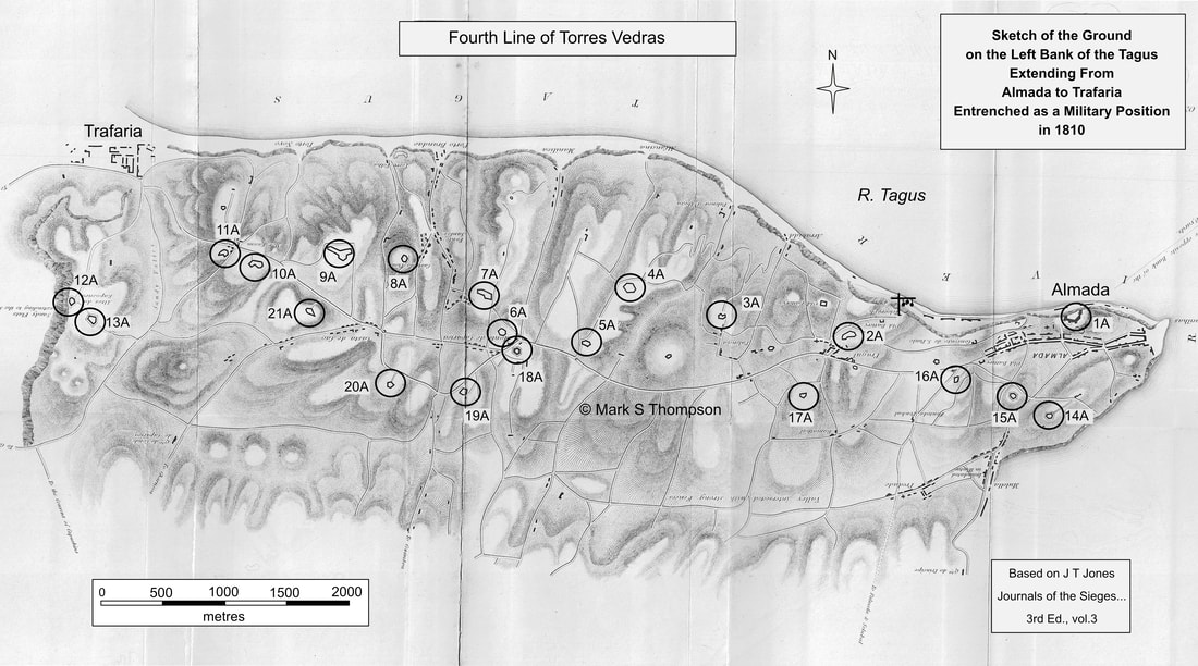
Forts on the Fourth Line to the South of the River Tagus.
​

There is little information available on the forts in the fourth line other than the drawings. The original plan was for 35 redoubts but this was reduced to 21.
Thanks to Antonio Lopes who has provided advice and the attached KMZ file which will open in Google Earth and show the locations of the main forts on the Fourth Line. 
linhas_de_torres_vedras_-_4º._linha__almada_.kmz
File Size: 4 kb
File Type: kmz
Download File

Picture

1A Castelo de Almada
2A Pragal
3A Palença
4A Raposo
5A Bixeiro
6A Prior
7A Granja
8A Castelo Picão
9A Montinhoso
10A Guedes
​


Back
11A Morfacem
12A Raposeira Grande
13A Raposeira Pequeno
14A Margueira
15A Alorna
16A San Sebastião
17A Armeiro-Mor
18A Mello
19A Pombal
20A Pissolos
21A Pêra


Proudly powered by Weebly