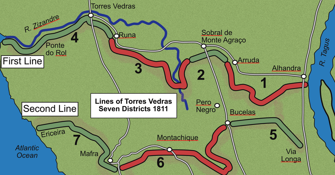
Districts and Forts on the Lines
When the Lines were originally occupied in October 1810, Wellington had divided the First and Second Lines into six districts. This was later increased to seven districts as additional forts were built.
|
First Line
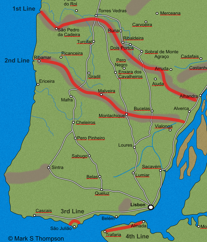
District number 1; from the Tagus at Alhandra to the Arruda road. District number 2; from the Arruda road to the left of Monte Agraço District number 3; from Zibreira to the Caduceira heights District number 4; from the left of the pass of Runa to the sea Second Line District number 5; from the Tagus to the pass of Bucellas District number 6; from the pass of Freixal to the park of Mafra District number 7; from the park at Mafra to the sea. Third Line On the Tagus around St Julian Fourth Line South of the Tagus from Almada to Trafaria |
|